LOURES
N 38º 49' 48''; W 9º 10' 12''
It is the seat of a municipality with 167.24 square kilometers of area and 205 054 inhabitants (2013), subdivided into 10 parishes. The municipality is limited to the north by the municipality of Arruda dos Vinhos, to the east by Vila Franca de Xira and by the Tagus estuary (territory officially assigned to Vila Franca de Xira), to the southeast by Lisbon, to the southwest by Odivelas, to the west by Sintra and northwest by Mafra.
The municipality comprises two cities: Loures and Sacavém and seven villages: Bobadela, Bucelas, Camarate, Moscavide, Santa Iria de Azóia, Santo António dos Cavaleiros and São João da Talha.
The municipality is divided into three major areas: rural, to the north (comprising Lousa, Fanhões, Bucelas, Santo Antão do Tojal and São Julião do Tojal); the urban, to the south (Frielas, Loures and Santo António dos Cavaleiros); and the industrialized, the east (Apelação, Bobadela, Camarate, Moscavide, Portela, Prior Velho, Sacavém, Santa Iria de Azóia, São João da Talha and Unhos).
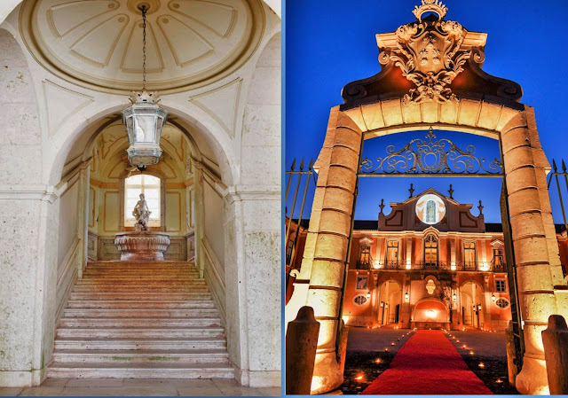
PALÁCIO DO CORREIO - MOR
N 38º 49' 39''; W 9º 11' 04''
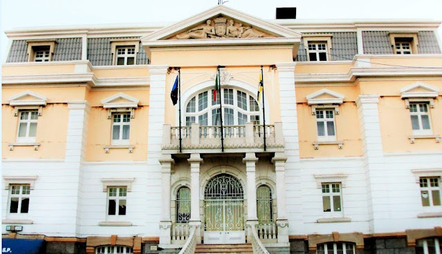
The Palácio do Correio-Mor is located in the rural term of the Portuguese parish of Loures (in the municipality of the same name) and is one of the most notable estates on the outskirts of Lisbon for its opulent stucco, tiles, and paintings decoration.
The palace dates back to the time of D. João IV (1640-1656) and has undergone several changes.
https://palaciodocorreiomor.pt/
 |
😍😍😍😍😍😍😍😍😍😍😍😍
SANTO ANTÃO DO TOJAL
N 38º 51' 13''; W 9º 8' 35''
Santo Antão do Tojal is an old Portuguese parish in the municipality of Loures, with an area of 15.13 km² and 4 216 inhabitants (2011). Its demographic density is 278.7 inhabitants / km².
Formerly called Santo António de Santo Antão do Tojal, the village is known for having served as a summer residence to the archbishops (later Patriarchs of Lisbon), who built the Mitra Palace here.












No comments:
Post a Comment